Fever Charts
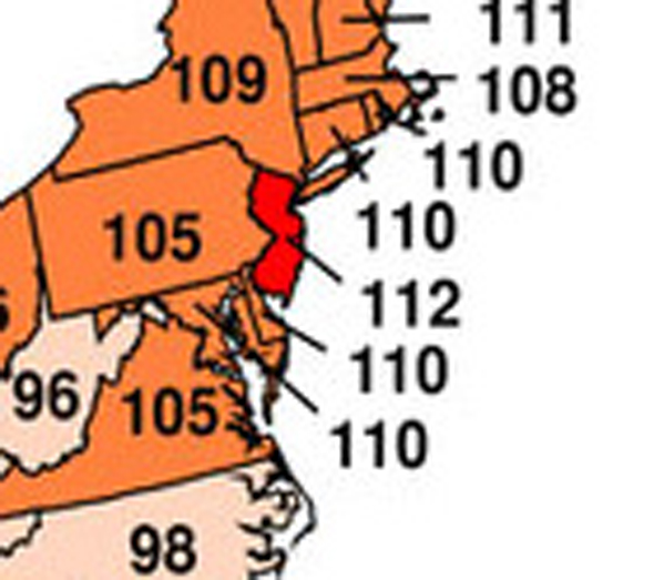
From the Sierra Club: several charts based on the National Climatic Data Center’s findings that 2006’s average U.S. temperature was the warmest on record!
The map breaks their findings down by state, so you can see which states had the worst “fever” last year.
Seriousness aside, notice that the big climate change loser last year was New Jersey. The New Yorkers I know are laughing…

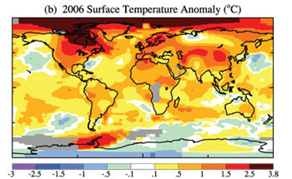
Below is a global map showing the areas of the world that were exceptionally hot.

Now we’re not laughing so hard.
The anomalous heat in the northern hemisphere reminds me of what Harmony guest and climatologist / oceanographer Amy Clement was saying: that ironically, much of America (currently the main source of carbon emissions) might become more lush because of global warming.
Also, what a strange increase in heat over the Antarctic Peninsula!


i’ll say! hot-time summer in the city!
Wow, sobering! I wish there were info about the chart since the scale is confusing — it can’t be “100 = normal” since the states labeled 88 to 99 are still colored above average; it can’t be high temps during the year (there’s no way FL didn’t exceed 92 for example); and its scale of “1 to 112” doesn’t mean anything to me without more info…. ANY CLUE?
Hey — good point. Delving deeper into site brings some clarity: 112 is the number of years they’ve collected data for each state. So the least-hot year of those 112 would be given a 1, and the most hot would be given a 112..
Cool, thank you! That means not only did NJ have its hottest year of the last 112 years, but *ten* states had one of their three hottest years of the last 112 years…